Offshore Weather Apps: NOAA, Fish Weather, and Windy, All Three
No single weather app tells the whole story, and offshore is the wrong place to find that out the hard way. I run three apps before every trip, each one answering a different question, and by the time I’m backing off the trailer I’ve got a real picture instead of one number I’m hoping is right. Here’s the stack, and why each piece stays on my phone.
NOAA marine forecast — the official word
Everything else in this article is built on top of NOAA’s own forecast, so it’s the one I check first. The National Weather Service marine forecast breaks the coast into zones, and each zone gets a written forecast plus a synopsis: wind direction and speed, seas in feet, and — the part that actually changes plans — small craft advisories, gale warnings, and the reasoning behind them. It’s not pretty and it’s not customized to your GPS pin, but it’s the source everyone else’s app is modeling from, and it’s the one place that will flat-out tell you not to go. When Fish Weather and Windy disagree, or when either one looks suspiciously calm, the zone forecast is the tiebreaker.
Fish Weather — the fast buoy glance
Fish Weather is the one I open for a quick look before I’ve even finished my coffee. It’s built around real NOAA buoy locations, so you’re looking at actual reported and forecast wind and wave data tied to a specific spot on the water instead of a generic regional number. I use it as the fast pass: pull it up, glance at the buoys near where I’m running, and get a read on wind and wave without digging through zone text. It’s not the tool I use for deep planning, but for “is today even worth the rest of the routine,” it’s hard to beat for speed.
Windy — saved spots, swell period, and everything else on the water
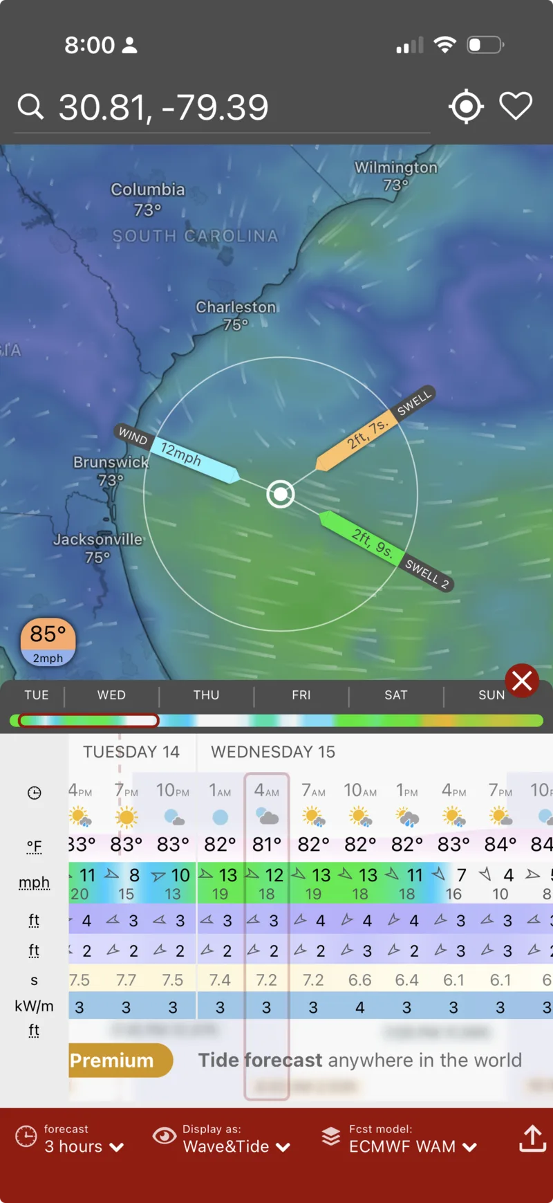
Windy is where I do the real planning, and the reason is the layers. Set up a free account and you can drop and save GPS points — my go-to canyons and bottom spots are pinned so I’m not re-entering coordinates every time — and pull forecasts for wind, wave, and, critically, swell wave with period as separate layers. That distinction matters more than most people realize: a forecast that just says “3 feet” could mean a clean, well-spaced groundswell or a sloppy wind-driven mess, and Windy is where I actually see which one it is before I leave the dock. On top of the marine layers, it also tracks rain, storm cells, and radar, so the same app that’s telling me swell period is also the one that tells me a cell is building on the way to the canyon.
How I actually stack them
In practice it’s a short routine, not three separate research projects: NOAA’s zone forecast first, for the official word and any advisories in play. Fish Weather next, for a fast buoy-based sanity check on wind and wave at the actual spot. Windy last, for the detail — swell period at my saved points, plus a look at the radar layer for anything building that isn’t in the written forecast yet. Three apps, maybe five minutes, and I’ve got a forecast, a reality check, and a storm check before the boat ever comes off the trailer.
Once you’re actually on the water, our own Live Buoy Conditions map is built for the same job with zero app download — real-time wind, wave, and water temp off the same NOAA buoy network, plus a Solunar Bite Times calculator for when to expect the bite once you’re anchored up. These three answer “should I go” — see the full trip-planning app stack for the apps that answer “where do I go once I have,” including RipCharts for SST and altimetry.
Bottom line
One app gives you one opinion. NOAA’s marine forecast is the official baseline and the one that’ll ground you when it needs to. Fish Weather is the fast buoy-based glance for a quick gut check. Windy is where the real planning happens — saved spots, swell period, and storm tracking in one place. Running all three costs nothing but a few minutes, and it’s caught more than one day that looked fine on a single app and wasn’t.
This article may contain affiliate links. If you buy through them, we may earn a small commission at no extra cost to you. Learn more.