Garmin ActiveCaptain App: What It Actually Does For You
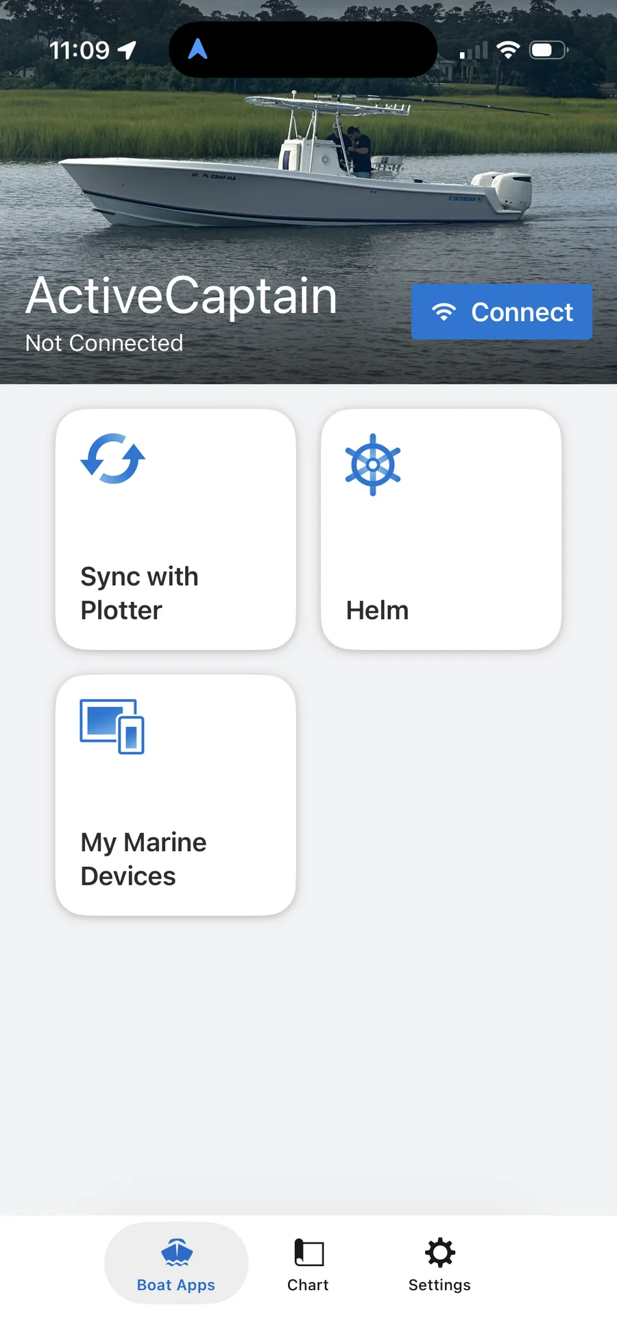
Every Garmin owner gets prompted to install ActiveCaptain at some point, and most people treat it like a one-time setup app and never open it again. That’s a mistake — it’s doing more than chart updates, and once you understand the pieces, it’s worth a spot on your phone’s home screen instead of buried in a folder. This is what it actually does, using my own boat’s device list as the example.
The one thing to understand first: two separate networks
ActiveCaptain doesn’t get its data from the internet through your chartplotter — the plotter’s Wi-Fi hotspot has no internet connection at all. Your phone downloads chart updates, firmware, and community content over its own cellular data or home Wi-Fi, same as any app. Then, at the boat, you connect your phone to the chartplotter’s own Wi-Fi network and everything you downloaded transfers over to the unit. Two separate networks, two separate jobs — download at the dock or at home on your own data, transfer at the boat over the plotter’s Wi-Fi. That “Connect” button on the home screen is what starts the second half of that process.
Sync with Plotter: your waypoints and tracks travel with you
This is the most-used feature day to day. Mark a waypoint on your phone, and Sync with Plotter pushes it to the chartplotter — and pulls waypoints, routes, and tracks the other direction too, so the two stay matched without manually re-entering anything. If you’re running Quickdraw Contours to build your own depth maps, this is also the path that contributes your logged depth data back to Garmin’s crowd-sourced Quickdraw community layer, and pulls down what other boaters have logged nearby. Chart updates themselves run through a separate feature called OneChart, not this one — worth knowing so you’re not looking in the wrong menu when a new chart release drops.
Helm: running the chartplotter from your phone
The “Helm” card mirrors and remote-controls the chartplotter’s display from your phone, once you’re connected to the unit’s own Wi-Fi — it’s local-range only, not a way to check your boat from home. It’s genuinely useful for anyone who’s wired an autopilot or trolling motor and wants to make a course adjustment from the cockpit or the bow instead of walking back to the helm. One thing worth knowing before you rely on it: full Helm control is a GPSMAP-family feature — ECHOMAP and STRIKER support it only on select models, so check your specific unit before assuming it’s there. See the full lineup breakdown if you’re not sure which family your unit falls in.
My Marine Devices: firmware for the whole network, not just the screen
This is the card that surprises people the first time they open it. It doesn’t just manage the chartplotter — it lists every device on the boat’s NMEA 2000 or Garmin Marine Network backbone with pending updates (see the boat networking overview if those terms aren’t familiar). Here’s what showed up on my own boat:
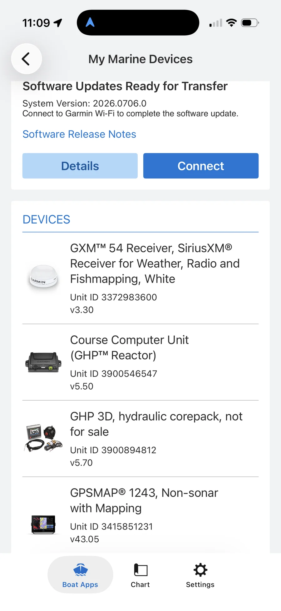
A GXM 54 SiriusXM receiver (weather and fish-mapping data), the GHP Reactor course computer that runs the autopilot, the GHP 3D hydraulic corepack behind it, and the GPSMAP 1243 chartplotter itself — four separate devices, four separate firmware versions, one screen. The process is the same two-step download-then-transfer model as everything else in the app: the update downloads to your phone over your own data connection, then transfers to each unit the next time you’re connected to the plotter’s Wi-Fi. Skipping this screen for months at a time is how you end up running a five-version-old autopilot computer without realizing it.
The part most people never scroll to: community content
Switch to the Chart tab and the green markers scattered across the water aren’t hazards or navigation aids — they’re crowd-sourced boater reviews. Garmin built this out from the original ActiveCaptain community site (a company it acquired back in 2017), and it now covers well over 100,000 marinas, anchorages, fuel docks, bridges, and boat ramps with photos, ratings, and current fuel prices posted by other boaters.
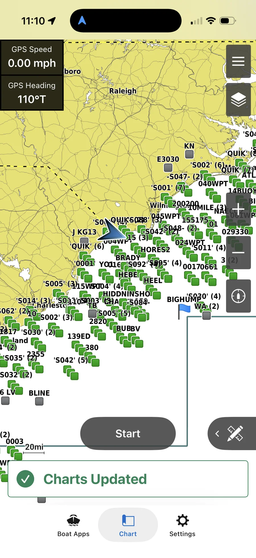
Tap any marker before a trip to a new inlet or marina and you’ll usually find someone’s actual experience with the fuel dock hours, the bridge clearance, or whether that “anchorage” on the chart is really just mud flat at low tide. It’s the same kind of information you’d normally get from a local’s advice, crowd-sourced at a scale no single guidebook matches.
Settings worth knowing about
The Settings tab covers the basics — vessel details, units, data usage limits (worth setting if you’re on a metered plan and don’t want the app pulling chart data on cellular by accident), and chart download preferences.
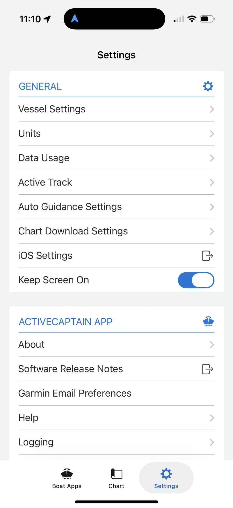
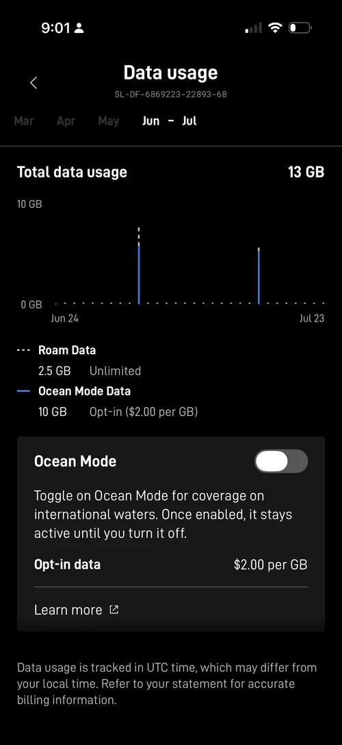
Most of it you’ll set once and never touch again, but the Data Usage setting is worth a look if you’re running Starlink or another metered connection at the boat — you don’t want a chart update chewing through gigabytes you’re paying $2 each for offshore.
Maps: subscription vs. buying the card outright
The app itself is free — what actually costs money is the chart content it delivers, and this is where Garmin gives you a real choice most owners don’t realize they have.
Navionics+ is the current subscription tier, sold as a download-and-one-year-subscription through ActiveCaptain and running roughly $100–$150 a year depending on region size. It covers 1-foot contours, Auto Guidance+, shallow-water shading, and the daily community updates covered above — downloaded to your phone, transferred to the plotter the same way as everything else in this app.
Navionics Vision+ is the step up, and it’s what’s behind bottom detail like this:
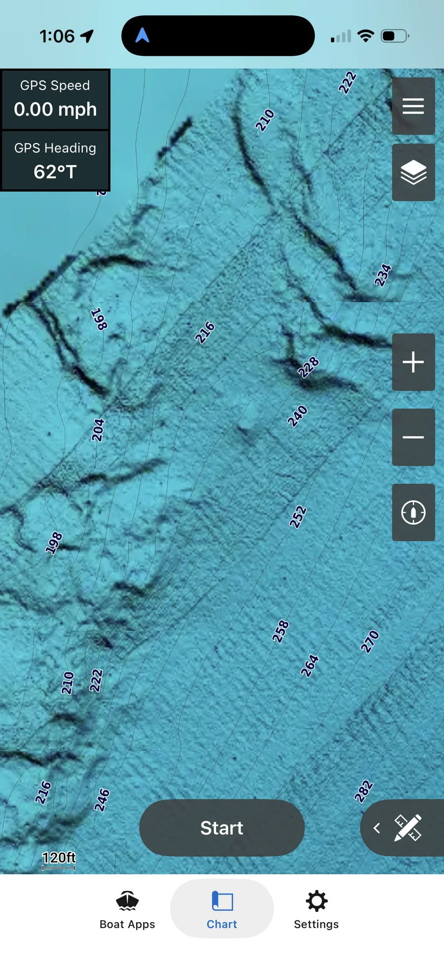
That’s relief shading — a 3D-style rendering of bottom contour and structure instead of a flat color fill between depth lines, and it makes a wreck, ledge, or hard-bottom patch actually look like terrain instead of a number on a topo line. Vision+ adds that relief shading plus high-resolution satellite imagery, sonar imagery, aerial photography, side-scan images, and Garmin’s 3D FishEye/MarinerEye views on top of everything Navionics+ already includes. List price runs $200–$250 a year, though it’s routinely discounted to $125–$150 at most retailers.
The one-time alternative most people don’t know is still for sale: Garmin still sells BlueChart g3 and g3 Vision cards outright — no subscription, no renewal, load it once and it’s yours. Garmin now labels it “previous-generation” cartography since Navionics+/Vision+ is the current push, but it’s still in stock and still supported. A g3 Vision card (same relief-shading feature set as Navionics Vision+) runs roughly $125–$355 depending on how much coverage you need, paid once instead of every year.
Do the math against your own fishing grounds: a g3 Vision card breaks even against a Vision+ subscription within one to two years, and after that it’s free for as long as the card works. If your waters don’t change much season to season — which describes most of the mid-Atlantic reef and wreck structure I fish — the one-time card is the better long-term value. If you’re running new inlets, chasing pelagics up and down the coast, or want the daily-updated community layer staying current without lifting a finger, the subscription earns its keep instead.
Either way, optional add-ons like OnDeck digital-switching monitoring are their own separate subscription if you’ve wired that in — ActiveCaptain is just the delivery mechanism for all of it, not a cost on top of it.
Bottom line
ActiveCaptain is the maintenance and information layer for a Garmin-networked boat: it keeps every device’s firmware current, keeps your waypoints and tracks synced between phone and plotter, gives you remote control from wherever you’re standing on the boat, and taps into a community-built database of marina and anchorage info that’s genuinely useful for planning a trip somewhere new. Open it before you leave the dock, not just when a software update nags you. It’s one piece of a bigger app stack — see the full offshore trip-planning lineup for the weather and charting apps that run alongside it.
This article may contain affiliate links. If you buy through them, we may earn a small commission at no extra cost to you. Learn more.